Home / Data: Planet, Coastlines, Buildings, Admins, Roads / Attribution
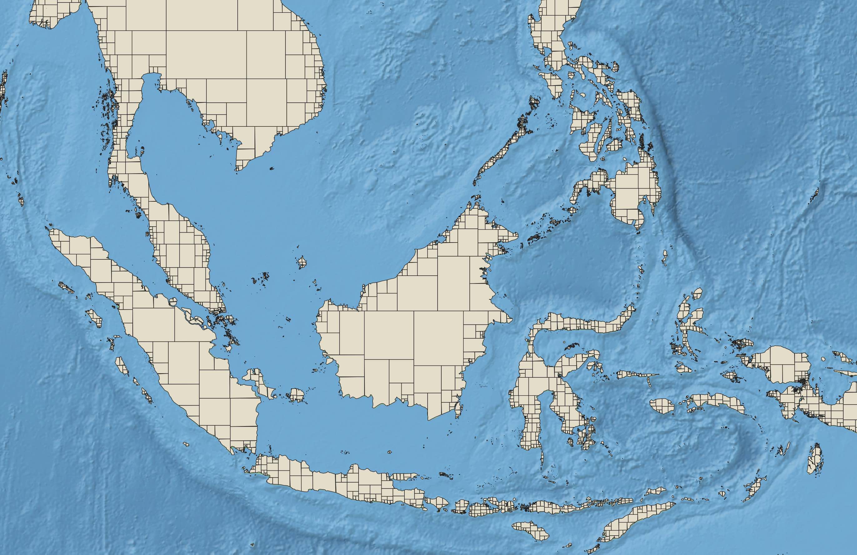
Daylight’s Coastline data contains detailed polygons representing global land area assembled from OpenStreetMap data. The sample image above shows Southeast Asia, Indonesia, Malaysia, and the Philippines. Each closed polygon is built from raw OpenStreetMap natural=coastline data, subdivided into optimal regions of similar complexity the excellent OSMCoastline tool.
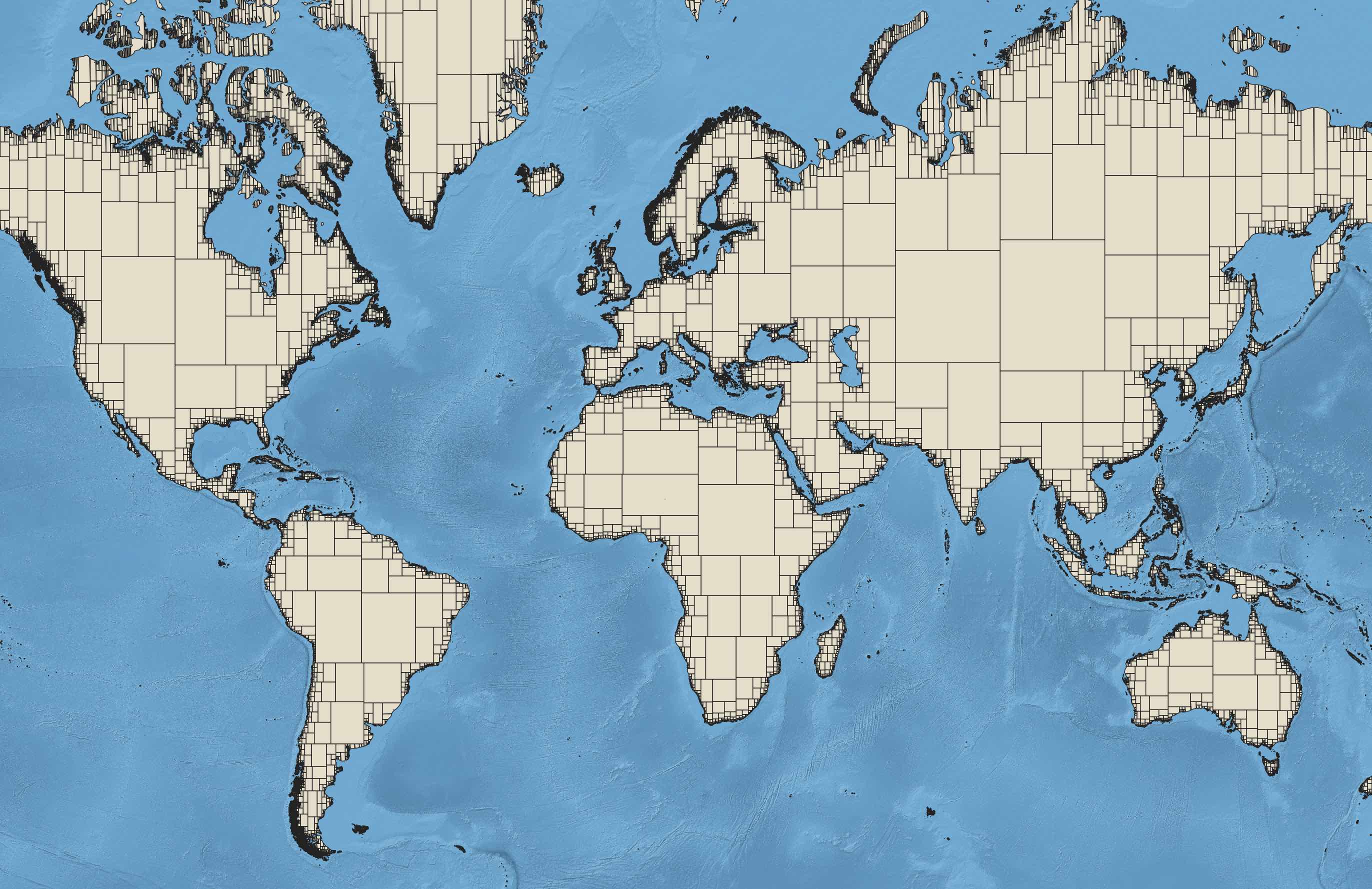
The extent of worldwide data is shown below.
Coastlines data is distributed as an Esri Shapefile compatible with all GIS software. To import it to PostgreSQL, use the PostGIS shp2pgsql data loader.
planet-v1.58.osm.pbf – Complete Daylight v1.58 in OSM PBF formatml-buildings-v1.58.osm.pbf – Microsoft Building Footprints addition to Daylight v1.58fb-ml-roads-v1.58.osc.gz – Facebook Experimental ML Roads addition to Daylight v1.58admin-v1.58.osc.gz – Administrative boundaries for Daylight v1.58coastlines-v1.58.tgz – Coastline land polygons for Daylight v1.58preferred-localization-v1.58.tsv – Additional translations for Daylight v1.58important-features-v1.58.json – Library of curated major map features for Daylight v1.58Coastlines in OpenStreetMap are challenging for map rendering, and typically come from a coastline rendering program that converts worldwide ways with natural=coastline tags into closed land/sea polygons and coastal linestrings.
The main problem of showing coastlines from OSM data is that many renderers really need closed polygons. The polygon can (and normally should) be made of several ways, but the ways should join end-to-end and eventually loop back round without interruption, to close the polygon. An imperfect coastline with many small gaps, reversed ways and other defects will cause the polygon to break, and the coastline to be rendered incorrectly. – OSM wiki
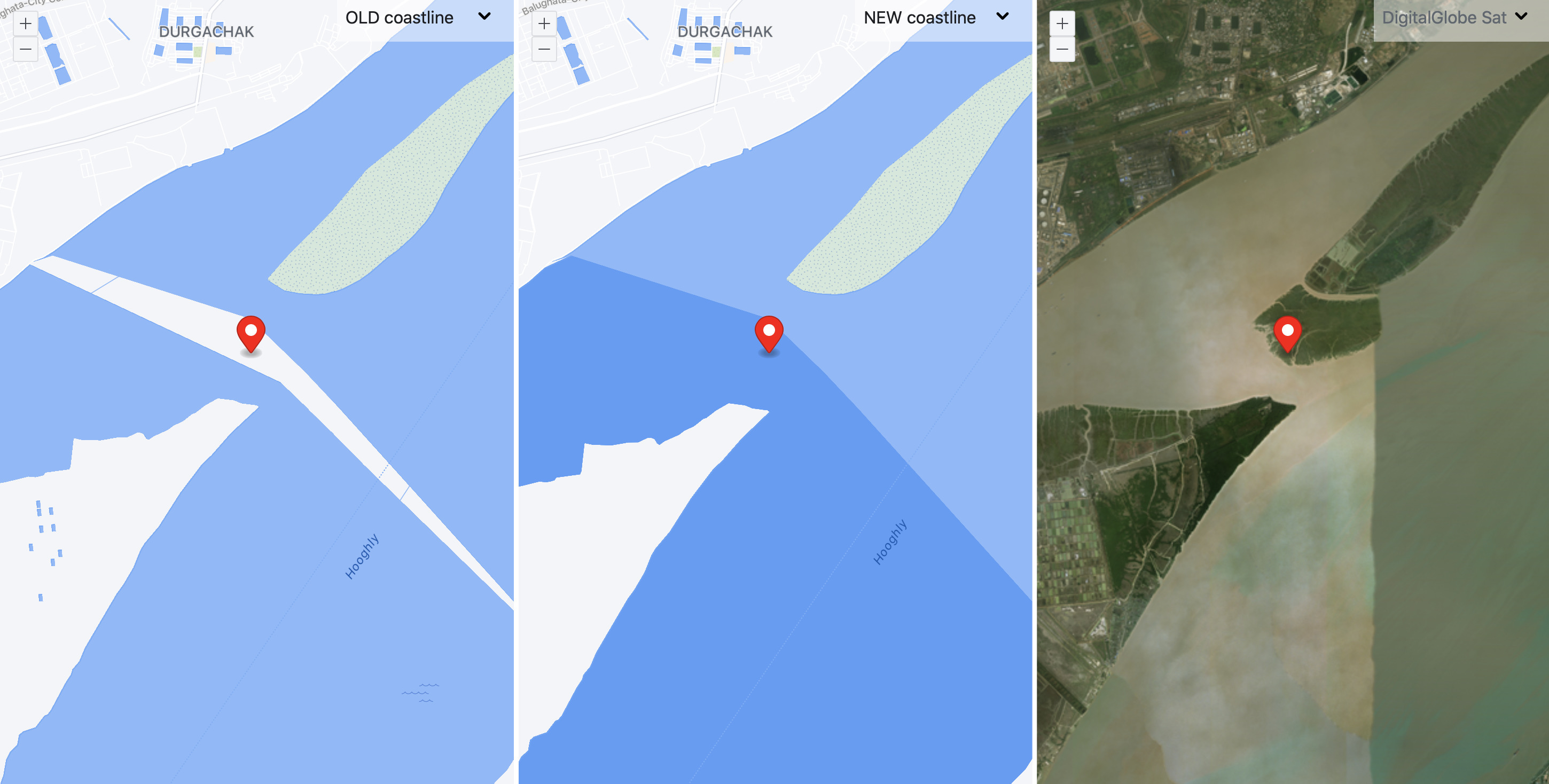
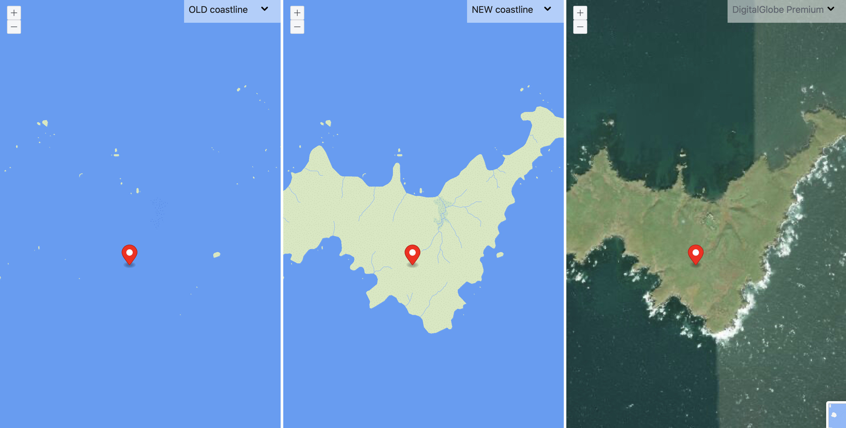
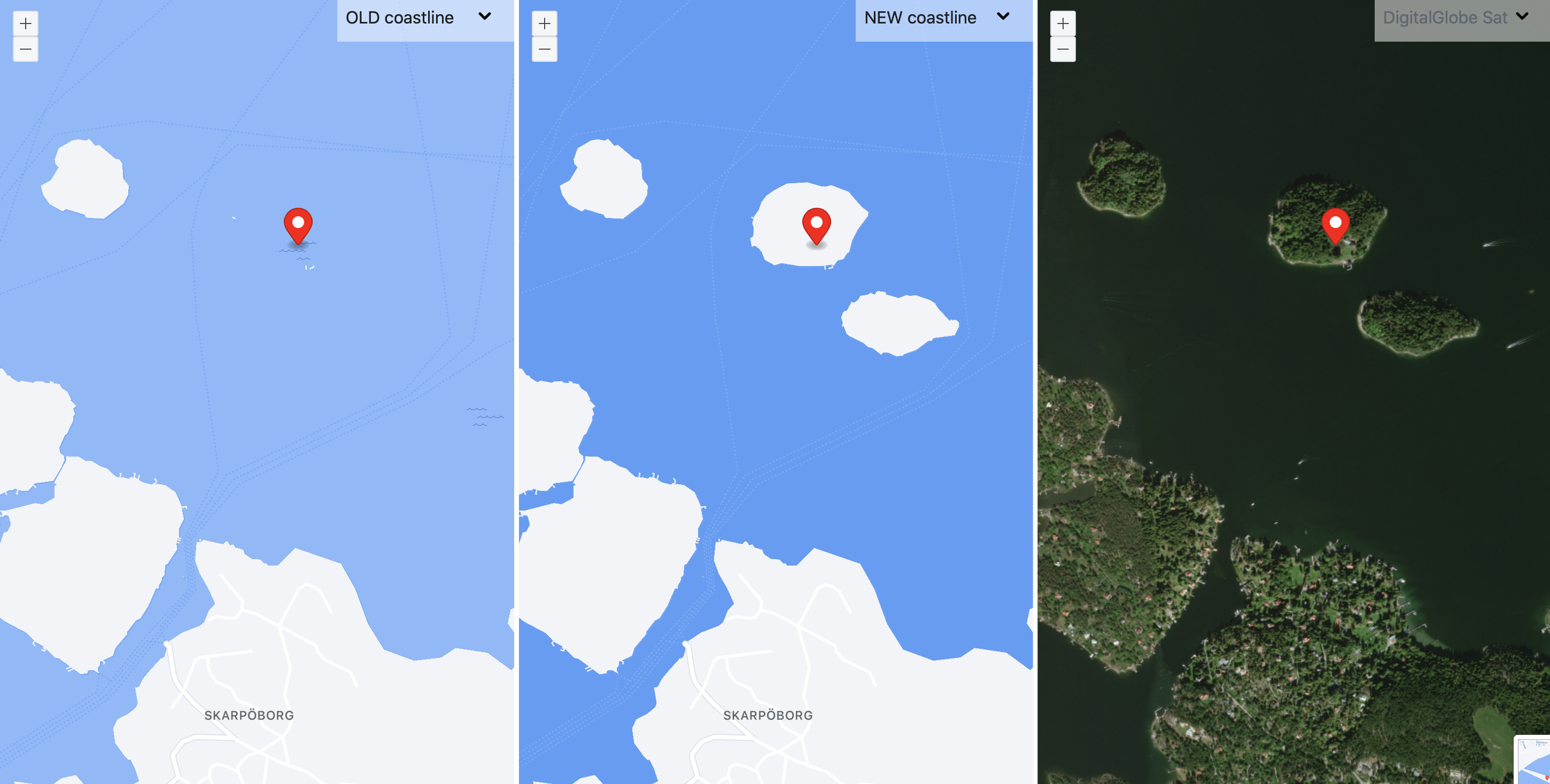
All coastline data in Daylight has been compared to underlying satellite imagery to check its likelihood of representing valid geographic features. Our editing team fixes common coastal data errors such as misalignments, missing islands, and omissions in small detailed coastal features.