Home / Data: Planet, Coastlines, Buildings, Admins, Roads / Attribution
Daylight building footprints is a joint product of Microsoft Building Footprints and Esri Community Maps Program. We combine the positional accuracy of Microsoft’s footprint data creation and authoritative tags such as name and address provided by authoritative sources in collaboration with Esri.
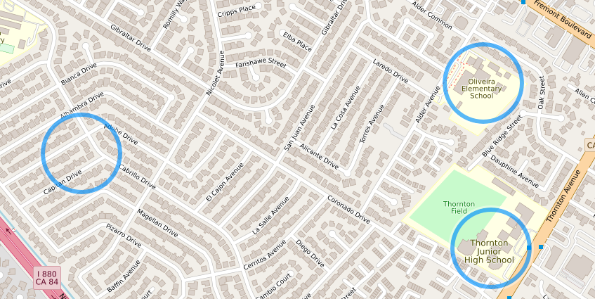
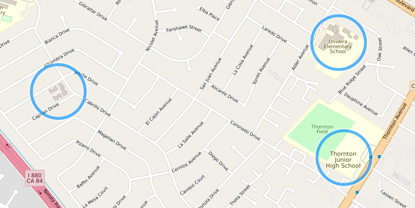
The image above shows Daylight building data, in contrast to the image below showing OpenStreetMap building data alone.
Use one of these two workflows to add Daylight Building Footprints to a map using only open source tools.
Use Osmium to merge the ml-buildings PBF with the Daylight Planet PBF before importing them to PostgreSQL database with osm2pgsql. Steps:
Use Osmium to merge the buildings and planet PBF files. Example:
osmium merge planet.osm.pbf ml-buildings.osm.pbf -o everything.osm.pbf
This will result in an ordered single combined PBF file called everything.osm.pbf.
Use osm2pgsql to import the output PBF from previous steps
Alternatively, import Daylight Planet PBF to PostgreSQL then import the ml-buildings PBF file separately. Steps:
Use osm2pgsql to import the Planet PBF
Use osm2pgsql --append to import the building PBF file
planet-v1.58.osm.pbf – Complete Daylight v1.58 in OSM PBF formatml-buildings-v1.58.osm.pbf – Microsoft Building Footprints addition to Daylight v1.58fb-ml-roads-v1.58.osc.gz – Facebook Experimental ML Roads addition to Daylight v1.58admin-v1.58.osc.gz – Administrative boundaries for Daylight v1.58coastlines-v1.58.tgz – Coastline land polygons for Daylight v1.58preferred-localization-v1.58.tsv – Additional translations for Daylight v1.58important-features-v1.58.json – Library of curated major map features for Daylight v1.58