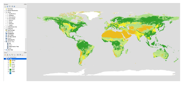
 using landcover from OSM
Home / Data: Planet, Coastlines, Buildings, Admins, Roads / Attribution
Oct 11th, 2023
Starting today, Daylight Map Distribution will include a new dataset consisting of vectorized landcover features derived from the European Space Agency’s 2020 World Cover (10m) rasters. This dataset provides global coverage and is suitable for use in maps up to 1:1 million (zoom level 8).
The Display Maps team at Meta serves beautiful maps to a variety of applications like Facebook, Instagram, WhatsApp, and many others using data from Daylight Map Distribution.
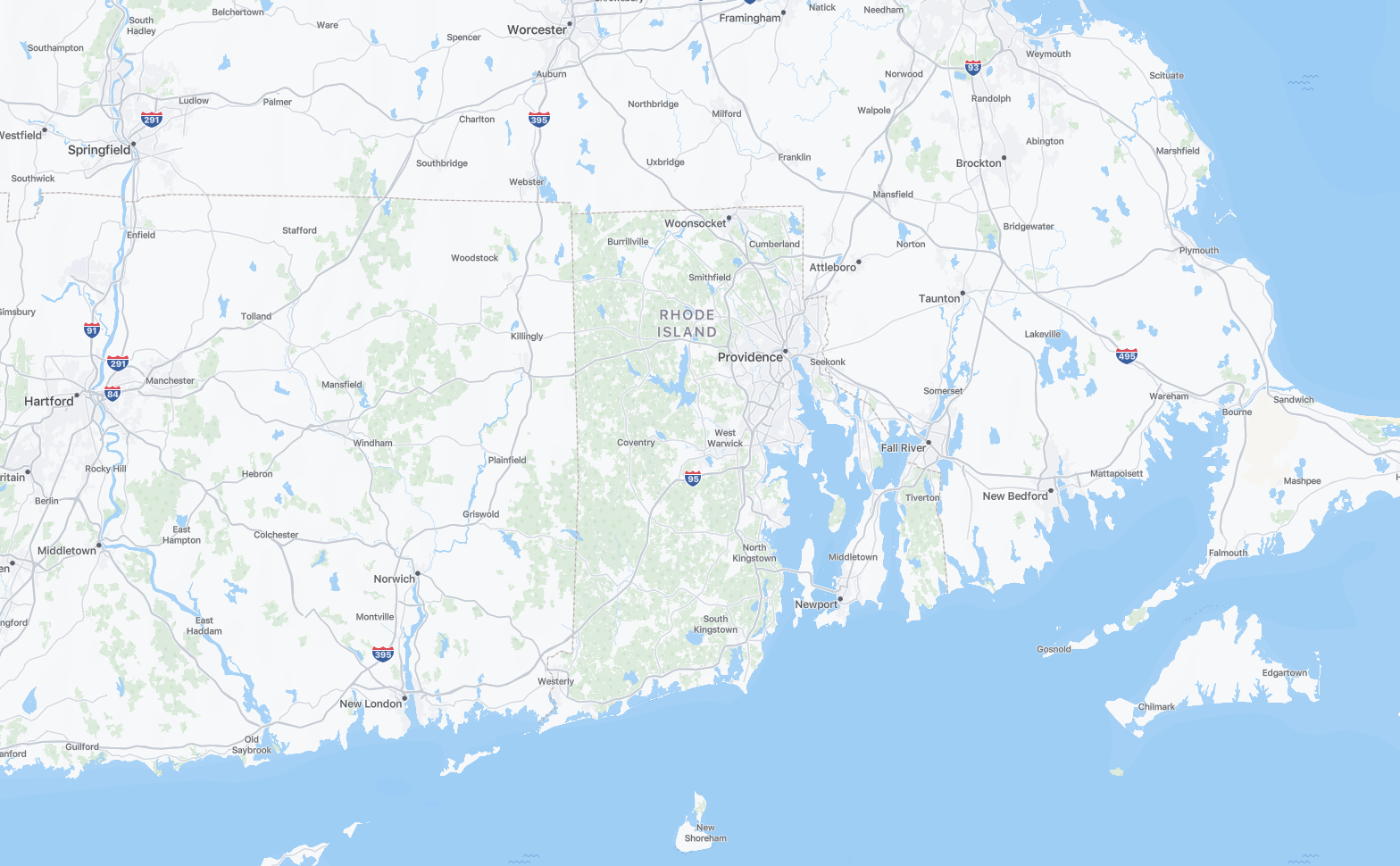
Previously our map at low zooms appeared bare, only displaying land, water, administrative boundaries, and labels. At mid zooms we introduced various natural and landuse tagged features from Daylight, but inconsistent global coverage made well mapped regions like Rhode Island look great and surrounding areas spotty.
using landcover from OSM
Landcover data provides an opportunity for the basemap to display continuous, gapless representation of the Earth’s natural surfaces. To include the ESA product in our maps, we designed a complex pipeline to (1) download the image tiles, (2) process them, (3) vectorize them, and finally (4) post-process them to a usable format for vector tiling.
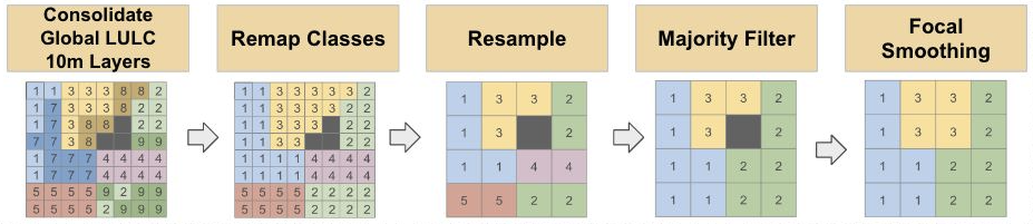
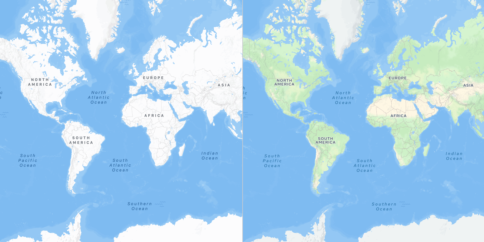
The 2651 Cloud Optimized GeoTiffs (COGs) originally with 11 land cover classes were remapped, and underwent raster-specific image processing largely involving de-noising and smoothing techniques including dilation and erosion of image arrays. The final dataset includes 8 main classes: Snow, Forest, Urban, Grass, Crop, Barren, Water, and Shrub. This stunning new dataset transforms our maps by displaying a continuous representation of the Earth’s natural surfaces. We’re pleased to make this same dataset available to the Daylight community to incorporate into your own maps.
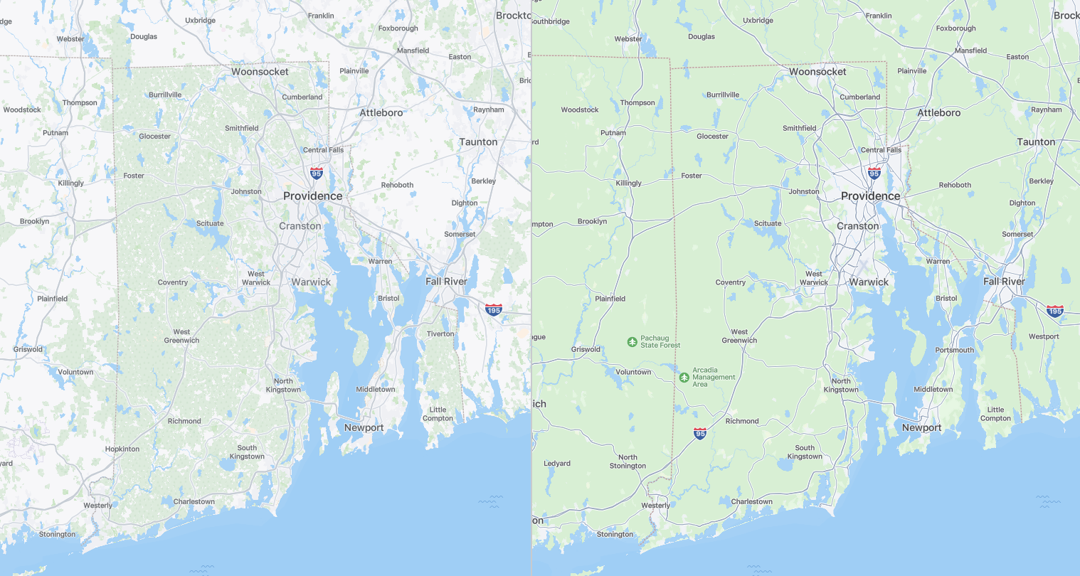
Rhode Island - before (left), after(right)
Default Style - before (left), after(right)
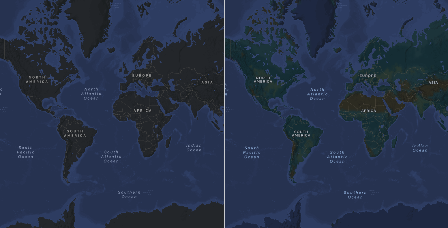
Dark Mode Style - before (left), after(right)
We hope this new product is useful to Daylight users, and would welcome and encourage feedback from the community. You can preview these new labels in action across all map surfaces at Meta, like:
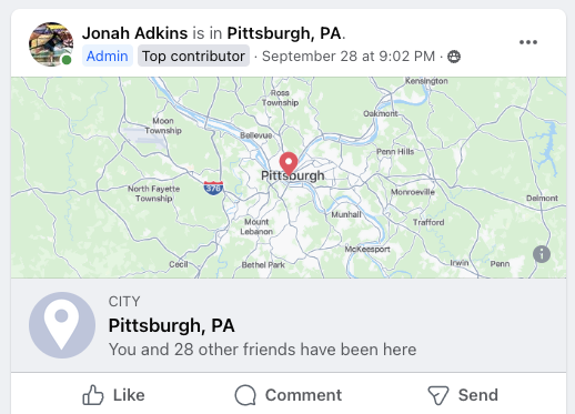
Facebook Check-Ins
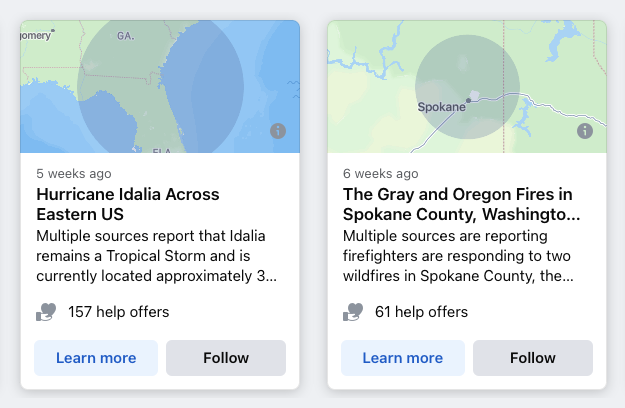
Facebook Crisis Response
as well as, on the Mapillary web app.
Download the shapefiles from s3: s3://daylight-openstreetmap/landcover/:
If you have any questions about this data distribution, we have created a #daylightdistro_feedback Slack channel in OSM US. Members of the team will be there periodically to answer questions. You can also email the team at osm@fb.com. Visit Maps at Meta for more information.