Home / Data: Planet, Coastlines, Buildings, Admins, Roads / Attribution
Mar 15th, 2023
Version 1.24 of Daylight Map Distribution now available for download.
📥 Download Daylight Map Distribution right now in OpenStreetMap PBF format: 📦 planet-v1.24.osm.pbf (70.0GB)
As always, coastlines, administrative boundaries, and buildings from our collaborators at Esri and Microsoft are also available:
Starting with Daylight v1.24, relations with type=building are now included in the Daylight output.
Following the earthquake that struck the Türkiye-Syria border on February 6, 2023, the OpenStreetMap community began mapping the affected area resulting in a significant number of new buildings and roads mapped. We prioritized ingestion in this region and were able to include a subset of the total contributions in this version of Daylight: 24,517 changesets comprising 1,105,671 nodes, 209,487 ways, and 129 relations for our daylight release. We hope that these efforts will help to improve the completeness of the map in the affected region. The remaining contributions will be added in the next release of Daylight.
A building relation in the City of Johannesburg Metropolitan Municipality, South Africa was repaired

A street name was updated to match street level imagery in Lee County, United States

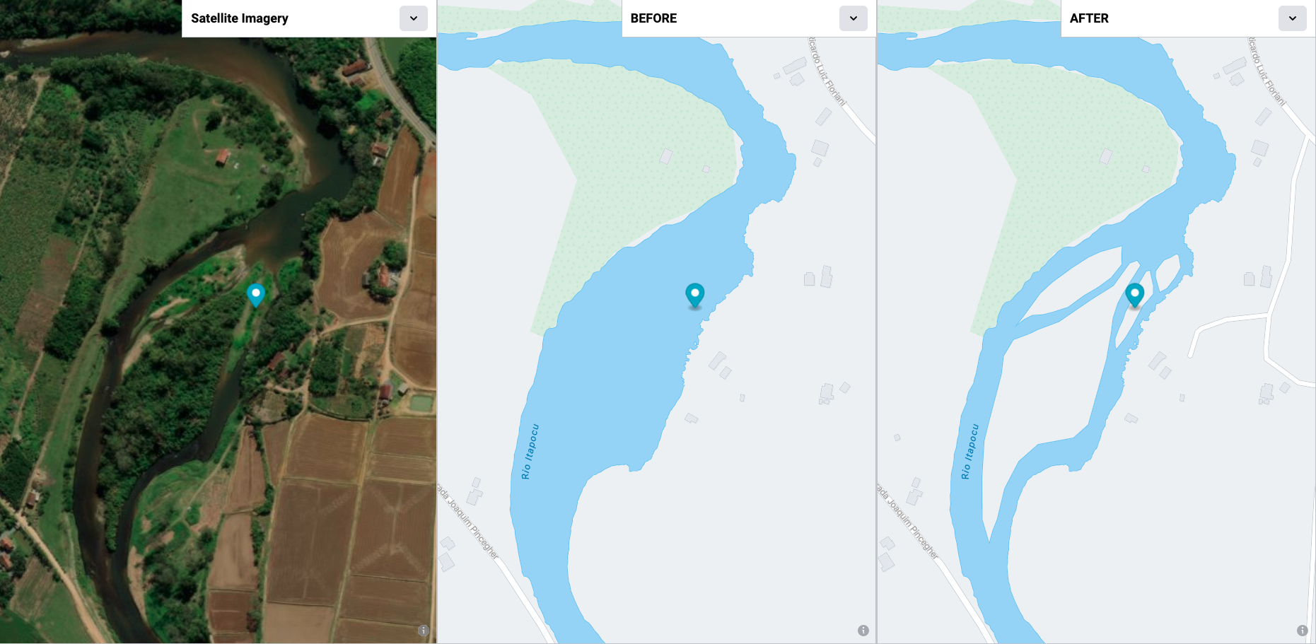
A cluster of islands within a river area in South Region, Brazil was repaired

Updated a long running river area in Santa Catarina, Brazil

Improved and aligned a building area to match satellite imagery in Rome, Italy

A building area was fine tuned by expanding southwards in Lombardy, Italy

Adjusted a shared node between two building areas in Naitasiri, Fiji

If you have any questions about this data distribution, we have created a #daylightdistro_feedback Slack channel in OSM US. Members of the team will be there periodically to answer questions. You can also email the team at osm@fb.com.
planet-v1.24.osm.pbf
– Complete Daylight v1.24 in OSM PBF format
ms-ml-buildings-v1.24.osc.bz2
– Microsoft Building Footprints addition to Daylight v1.24
fb-ml-roads-v1.24.osc.bz2
– Facebook Experimental ML Roads addition to Daylight v1.24
admin-v1.24.osc.bz2
– Administrative boundaries for Daylight v1.24
coastlines-v1.24.tgz
– Coastline land polygons for Daylight v1.24
grab-ml-roads-v1.24.osc.bz2
– Grab ML detected roads addition to Daylight v1.24
preferred-localization-v1.24.tsv
– Additional translations for Daylight v1.24
important-features-v1.24.json
– Library of curated major map features for Daylight v1.24